California State Route 58: A Scenic and Strategic Highway Spanning Southern California

California State Route 58: A Scenic and Strategic Highway Spanning Southern California
California State Route 58 (SR 58) is more than just a roadway—it’s a fascinating journey across some of the state’s most diverse landscapes, from rolling coastlines to sun-drenched deserts. Spanning approximately 241 miles from Santa Margarita to Barstow, this east-west corridor is often overlooked by travelers. Yet, it remains a pivotal route connecting vital regions of the Golden State. Below, we’ll explore the scenic highlights, historical context, and modern upgrades that make SR 58 such a compelling part of California’s highway system.
A Tale of Two Terrains (Well, Actually Four)
-
Coast Ranges
-
The highway starts near Santa Margarita in San Luis Obispo County, where it weaves through picturesque mountain roads.
-
The nearby Carrizo Plain offers a unique glimpse into the San Andreas Fault and sweeping grassland vistas.
-
-
San Joaquin Valley
-
After intersecting State Route 33 in McKittrick, SR 58 heads east and briefly merges with Interstate 5 near Buttonwillow.
-
Here, you’re in the heart of California’s agricultural hub, surrounded by vast farmland and a thriving produce industry.
-
As you approach Bakersfield, the highway transitions to the Westside Parkway, linking travelers directly to State Route 99.
-
-
Tehachapi Mountains
-
East of Bakersfield, SR 58 morphs into a freeway and climbs the Tehachapi Pass—a crucial connection between the Central Valley and the Mojave Desert.
-
This mountainous stretch offers spectacular views and a sense of the rugged landscape that defines the region.
-
-
Mojave Desert
-
Descending into the Antelope Valley near Mojave, SR 58 continues its desert journey.
-
You’ll pass by Edwards Air Force Base, one of America’s premier military flight test centers.
-
The route crosses U.S. Route 395 at Kramer Junction before finally meeting Interstate 15 in Barstow.
-
A Highway Rich in History
-
Former Routes: Portions of SR 58 once belonged to U.S. Route 466 and State Route 178, carrying travelers long before the modern highway system took shape.
-
Renumbering: The 1964 highway renumbering consolidated these segments into the route we know today as SR 58.
-
Cultural Significance: Along its length, the highway is known by names such as the Rosa Parks Highway and the Kern County Korean War Veterans Memorial Highway, showing its deep regional and historical ties.
Modern Developments and Upgrades
-
Centennial Corridor Project: Perhaps the most significant recent development, this project in Bakersfield streamlined connections between SR 58 and SR 99, improving traffic flow for locals and long-haul travelers alike.
-
Safety and Capacity Improvements: Over time, stretches of SR 58 have been widened or realigned to handle heavier traffic volumes and enhance driver safety, especially in mountainous or desert terrains.
Why SR 58 Deserves Your Attention
-
Diverse Scenery: Few highways offer such a rapid transition from coastal mountains to sprawling desert. It’s a treat for anyone who appreciates dramatic landscapes.
-
Strategic Importance: It’s not just about the views—SR 58 plays a vital role in freight movement, linking central California produce to national supply lines.
-
Gateway to Adventure: Whether you’re heading to the coast for a weekend getaway or driving to the desert to explore iconic sights like the Mojave National Preserve, SR 58 is often the fastest and most direct route.
Final Thoughts
California State Route 58 may not be as famous as coastal Highway 1 or bustling Interstate 5, but it delivers a distinctive blend of natural beauty and practical connectivity. From the agricultural heart of the San Joaquin Valley to the stark expanses of the Mojave Desert, SR 58 showcases the best of California’s diverse landscapes. Whether you’re a history buff fascinated by old highways or simply seeking a scenic drive, SR 58 offers plenty of surprises and stunning views along the way.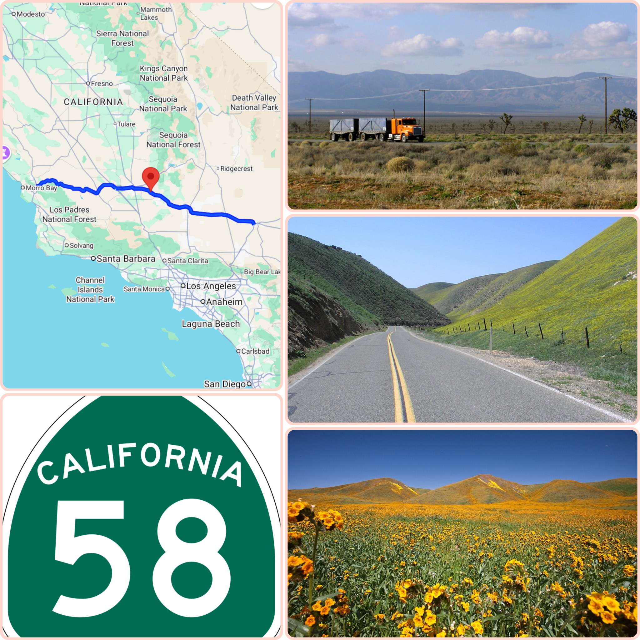
Categories
Recent Posts